
Showing posts with label Shenandoah National Park. Show all posts
Showing posts with label Shenandoah National Park. Show all posts
Friday, July 20, 2012
Shenandoah National Park Guide to the Central District - July 2012
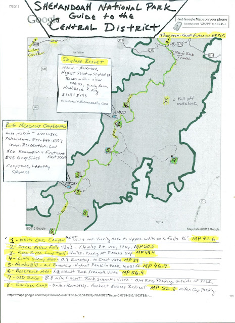
I recently went camping at Big Meadows, and I am planning another camping trip with a group of friends to the Central District again very soon. I've done a lot of hiking in this area of the park, and find it to be the most compacted with very rewarding and popular hikes. I thought I'd make a map to provide a better visual of distance and layout of the central district of Shenandoah National Park to others. I've included waterfall hikes, and vista hikes, along with two areas for overnight lodging. Along with the details, I've included the Mile Posts where each trail starts, as well as where the car pull off overlooks are located. Below is the helpful map for friends I created.

Subscribe to:
Posts (Atom)